East Leeds Orbital Route Cycling Strategy
The East Leeds Orbital Route must prioritise safe, continuous cycling infrastructure that delivers measurable modal shift from private cars to active travel for work, education and leisure trips. Investment along the orbital corridor will reduce local traffic pressure, improve access to employment areas such as Thorpe Park, and connect neighbourhoods east of the city to the wider Leeds and West Yorkshire network.
Strategic Context and Policy Framework

National policy now frames cycling as core to decarbonisation and healthy streets, with the Department for Transport’s Gear Change reforms and the Cycling and Walking Investment Strategy committing to higher quality, segregated provision where demand exists. Active Travel England oversight and national net zero targets to 2050 further require durable schemes that deliver long term modal change. At the regional level, West Yorkshire Combined Authority transport priorities emphasise inclusive access, road safety and connecting housing and jobs. Leeds City Council’s transport plans and the emerging Local Plan support modal shift, with explicit objectives to increase cycling uptake to support congestion reduction and air quality improvements. Objectives for the orbital route include safe cross city connections, enabling first and last mile journeys, and delivering a continuous corridor that integrates with existing cycle routes and public transport nodes.
Existing Cycling Infrastructure Adjacent to the Orbital Route
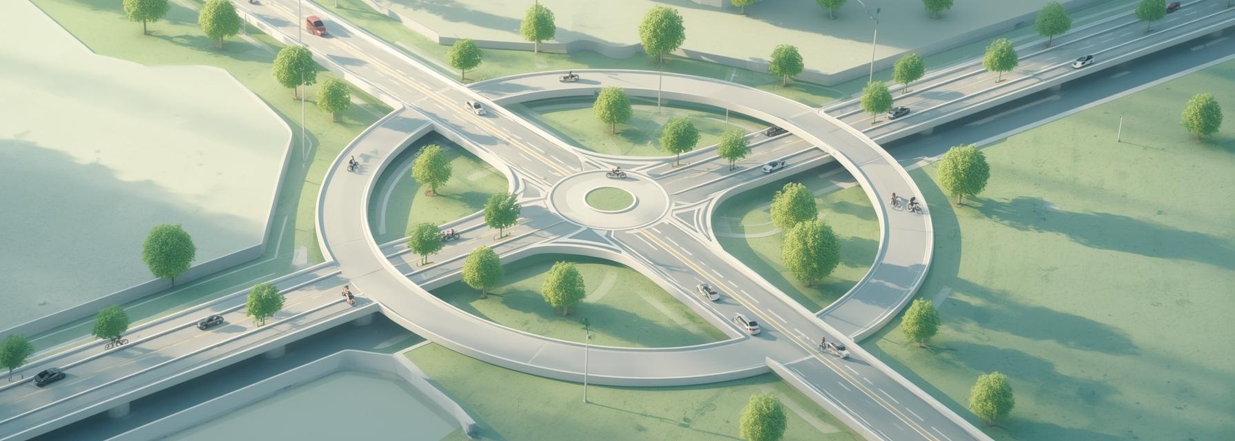
Adjacent infrastructure comprises a mix of on-street painted lanes, advisory lanes on some arterial streets, and off-road shared paths through parks and former rail alignments. The corridor intersects parts of the National Cycle Network and local active travel corridors delivered under CityConnect. Key constraints are discontinuous lane surfacing, narrow shared paths that create conflict between pedestrians and cyclists, and limited secure cycle parking at employment destinations. Junctions at major radial roads and the A6120 outer ring show inconsistent crossing facilities and pinch points where sidewalks narrow and cycle lanes drop. End of trip facilities are uneven, with a few sheltered bike racks at retail parks and limited staffed cycle hubs near employment clusters.
Identified Gaps, Barriers and User Needs
Severance remains a primary barrier: long radial roads and motorway linkages create psychological and physical divides that deter less confident cyclists. Safety hotspots concentrate at junctions with high heavy vehicle flows, limited sightlines and inadequate crossing protection. Accessibility concerns affect cargo bikes, adapted cycles and users with mobility differences who require wider clearances and gentler gradients. Perceptions of cycling risk, poor year round maintenance, and lack of coherent wayfinding suppress uptake among commuters and school journeys. Addressing these needs requires continuity, protection, and visible maintenance commitments.
Proposed Cycling Infrastructure Interventions
Delivering a credible offer along the orbital corridor means a hierarchy of interventions. Continuous segregated cycle tracks alongside the carriageway will give faster, confident riders direct routes, while parallel quietways through residential streets and green corridors will provide lower stress options for families and less experienced riders. Junction redesigns need protected intersections with corner refuge islands, cyclist priority phases and raised crossings. Distributed secure cycle parking, small hubs near bus interchanges, and intermodal facilities at major employment sites will enable mixed commutes.
Design Standards, Materials and Technical Details
Application of national and local design guidance must be explicit, following current Department for Transport cycle infrastructure standards and Leeds City Council technical notes. Minimum one way track widths should be 2.0 to 2.5 metres where possible, with two way sections at least 3.0 metres plus clearance. Durable surfacing such as high grade asphalt with proper longitudinal falls and sealed edges will reduce maintenance. Drainage must prevent standing water and salt damage during winter. Signal timing and detection should include cyclist call buttons, loop free detection, and priority phases at key junctions to reduce delay. Interfaces with bus lanes and heavy goods vehicle routes require physical separation and clear priority markings to prevent user conflict.
Connectivity and Network Integration
Connections must link residential catchments to employment areas, schools and health facilities. The corridor should provide direct links to Thorpe Park employment area, retail clusters and to the wider Leeds cycle network and National Cycle Network routes that serve East Leeds. Cross boundary coordination with neighbouring authorities will ensure continuity for longer regional trips.
Safety, Comfort and Inclusive Design Measures

Physical protection using kerbs, continuous raised separators and planting improves perceived safety. Lighting design must meet sightline standards and promote passive surveillance at crossings. Design must accommodate cargo bikes and adapted cycles via turning radii, docking bays and wider ramped access. A clear maintenance regime, including winter gritting and regular sweeping, is essential to preserve year round usability.
Environmental, Health and Place-making Benefits
Reduced car trips will improve local air quality and lower noise levels near schools and homes. Planting native species along green corridors supports biodiversity and provides shading and wind shelter for cyclists. Increased active travel promotes cardio vascular health and improved equity of travel access across neighbourhoods, while streetscape enhancements elevate local place value and support walking as well.
Land Use, Planning and Property Constraints
Delivery will need detailed land assessments for acquisition, easements and rights of way. Impacts on frontages must be managed through coordinated design with developers, ensuring continuity where new developments abut the corridor. Utility diversions and underground constraints require early engagement with statutory undertakers and may influence alignment choices.
Funding, Economics and Value-for-Money
The following summarises capital ranges, likely funding sources and expected benefits for core interventions. Text before this summary outlines likely funding mix and benefits. After the figures, funding priorities and maintenance responsibilities are described.
| Intervention | Typical capital range per km | Potential funding source | Primary monetised benefits |
|---|---|---|---|
| Segregated two way track | £300,000–£900,000 | Active Travel grants, WYCA, developer contributions | Reduced collisions, travel time savings, health gains |
| Protected junction upgrade | £150,000–£600,000 each | Transforming Cities Fund, local funding | Significant safety improvement, reduced delay |
| Quietway / green corridor | £80,000–£250,000 per km | Local transport budgets, section 106 | Mode shift for local trips, amenity gains |
| Cycle hub and parking | £50,000–£250,000 per hub | LEP funds, employer contributions | Increased secure cycle storage, multimodal use |
Capital costs vary with land acquisition and utility works. Value for money improves markedly when safety and health benefits are included. Revenue funding must cover routine maintenance, with clear assignment to Leeds City Council or WYCA within partnership agreements.
Delivery, Monitoring and Engagement

Phased delivery aligned to main carriageway works reduces disruption. Temporary diversions and well signposted detours will maintain active travel during construction. Baseline monitoring using automated counts and periodic user surveys will establish performance against KPIs for modal shift, safety and user satisfaction. A targeted engagement programme with residents, schools and employers will support training, hire schemes and marketing to lock in behaviour change and build lasting support.